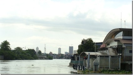
Located along the southeastern end of the City of Manila is the district known to many as Santa Ana. Or as it proudly states on its welcome marker, “the historic community of Santa Ana.”

Santa Ana by itself has a colorful past that has much been overlooked other than its repuation of having a race track which is NOT evenlocated in the area. (and the race track itself today is no longer in operation, but that’s another story)
Santa Ana of the old (during the pre-Hispanic times to be precise) was part of a kingdom which is said to be the oldest and one of the largest in what is now present-day Manila: the kingdom of Namayan. Technically, it’s said to be more like a confederation of independent kingdom-barangays under one leader, who, by the time the Spaniards came, was a fellow named Lakan Tagkan with his wife Buan. This kingdom of Namayan not only included modern Santa Ana but also other parts of today’s Manila like Quiapo, Sampaloc, Malate, as well as what are now Pasay, Mandaluyong, Makati, to as far as Taytay in the province of Rizal. The capital of Namayan is a village known as Sapa or Maysapa, so called because of its proximity to the Pasig River and nearby creeks or esteros. (sapa in Tagalog) It was from here that the Santa Ana we know today would arise.
While little trace is left of the once-powerful kingdom of Namayan, its memory lives on with a street in Santa Ana called “Lamayan.” While the word “Lamayan” means mourning in Tagalog, it actually recalls the old kingdom through its one of its other names.
Santa Ana soon fell to Spanish rule in 1571, along with the rest of Manila. The Spaniards wasted no time in establishing a settlement there. In 1578, the Franciscan missionaries founded a parish there, dedicated to Virgin Mary’s mother, St. Anne. The name of this new settlement: Santa Ana de Sapa.
Modern Santa Ana is divided into two parts, the historic Santa Ana proper which is located south of the Pasig River bordering Makati City, and Punta or the northern part of Santa Ana located on the opposite bank and bordering Mandaluyong City. Both offer contrasting images that has defined modern Santa Ana district, as well as that of the City of Manila as well.

If there’s one thing that has defined Santa Ana then and now, it would be its link with the Pasig River. Its old name of Santa Ana de Sapa is a testament to the fact. The Pasig River was, after all, the river which made Santa Ana thrive throughout its existence in a demographic, commercial, and social context. Even today, you can see how important and intricate the river’s link is to Santa Ana, thanks to its river transport that not only serves as a link between Punta and Santa Ana proper but has somehow become a way of life in this part of the city, in the midst of modern infrastructure and transportation the city has seen over the years.
While the old glory of Namayan may have long gone, Santa Ana still has a rich legacy of its own. By itself, it has this charm that has not yet been fully appreciated in the midst of a city dismissed as chaotic and gloomy. An urban roamer may be surprised to see what Santa Ana has to offer.
©The Urban Roamer


2 Comments
taccarrex
I was told that Lamayan Street was so named because that’s where
Panday Pira worked overnight (naglalamay) making small cannons. When Spain
conquered Mexico, Peru etc., the American Indians were so awed by the
Spanish cannons but when Legaspi fired his guns at Rajah Soliman’s
kingdom of Manila, he was surprised when Soliman’s warriors fired back
with their own cannons (made by Panday Pira). The Pre-Hispanic “Filipinos”
learned cannon making from the Arabs that where there before the Spaniards.
Your comments/corrections will be greatly appreciated.
mywastedspace
that was the first time I heard about the story of Lamayan St. we may not get to know the real story behind but thanks for sharing.
thanks also for sharing about Panday Pira. almost passed my mind he was also a Santa Ana native.